WHERE CAN I FLY MY DRONE (UAV)?

The United States’ Federal Aviation Administration (FAA) has jurisdiction over airspace and is responsible for making sure that air traffic flies smoothly, efficiently, and safely. Anyone operating a drone (UAS) must follow FAA regulations and should know where one can and cannot fly. In this article, we will walk through two different resources produced by the FAA to ensure hobbyist all the way up to industrial drone operators know where it is safe to fly.
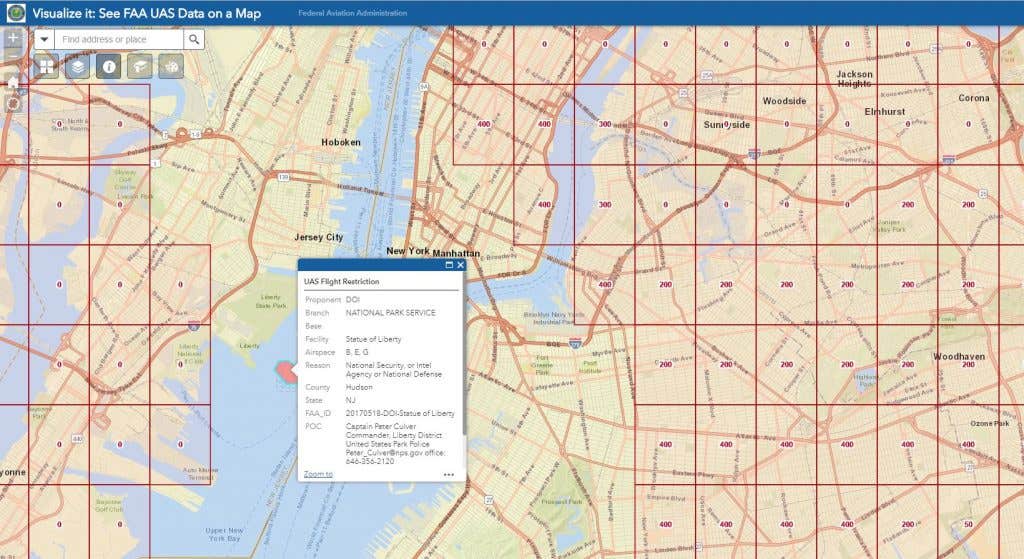
The FAA’s Visualize It map makes it simple to see where airports, military training bases, and national monuments are located. Once the webpage is loaded type in the city or location into the search bar at the top of the page. The site will take you to the area you have requested and overlay airspace data. This map, is particularly helpful since it shows the different flight ceilings (it’s not always 400 ft). In the past, you would have to be very familiar with sectional charts and airspace classification, but now all that data is overlayed on an easy to follow quadrant by quadrant web-based map.
“Read the full blog post on Dronefly.com“


